Category:PD map
Jump to navigation
Jump to search
| NO WIKIDATA ID FOUND! Create new Wikidata item | |
| Upload media |
See the maps section of Commons:Threshold of originality.
Media in category "PD map"
The following 200 files are in this category, out of 408 total.
(previous page) (next page)-
1968 US Presidential Election by Popular Vote.svg 512 × 325; 51 KB
-
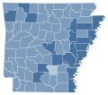
2004 Arkansas Amendment 3 results map by county.svg 744 × 655; 382 KB
-
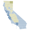
2004 California Proposition 71 results map by county.svg 744 × 744; 595 KB
-
2004 US Presidential Election by Popular Vote.svg 512 × 325; 46 KB
-
2006 California Proposition 85 results map by county.svg 744 × 744; 595 KB
-
2008 US Presidential Election by Popular Vote.svg 512 × 325; 46 KB
-
2010 California Proposition 17 results map by county.svg 744 × 744; 595 KB
-
2010 California Proposition 20 results map by county.svg 744 × 744; 595 KB
-
2010 California Proposition 21 results map by county.svg 744 × 744; 595 KB
-
2010 California Proposition 22 results map by county.svg 744 × 744; 595 KB
-
2010 California Proposition 23 results map by county.svg 744 × 744; 595 KB
-
2010 California Proposition 24 results map by county.svg 744 × 744; 595 KB
-
2010 California Proposition 25 results map by county.svg 744 × 744; 595 KB
-
2010 California Proposition 26 results map by county.svg 744 × 744; 595 KB
-
2010 California Proposition 27 results map by county.svg 744 × 744; 595 KB
-
2010 Maine gubernatorial election results map by county.svg 810 × 810; 43 KB
-
2012 California Proposition 28 results map by county.svg 744 × 744; 595 KB
-
2012 California Proposition 29 results map by county.svg 744 × 744; 595 KB
-
2012 California Proposition 30 results map by county.svg 744 × 744; 595 KB
-
2012 US Presidential Election by Popular Vote.svg 512 × 325; 46 KB
-
2014 Illinois gubernatorial election results map by county.svg 810 × 810; 43 KB
-
2014 Wisconsin gubernatorial election results map by county.svg 810 × 810; 43 KB
-
2014 Wyoming gubernatorial election results map by county.svg 810 × 624; 15 KB
-
2016 Indiana Attorney General election results map by county.svg 810 × 810; 35 KB
-
2016 US Presidential Election by Popular Vote.svg 512 × 325; 50 KB
-
2017 Virginia Attorney General election results map by county.svg 810 × 358; 94 KB
-
2018 Arkansas Issue 5 results map by county.svg 744 × 655; 382 KB
-
2018 Illinois gubernatorial election results map by county.svg 810 × 810; 43 KB
-
2018 IN US Senate Democratic primary.svg 248 × 383; 35 KB
-
2018 Michigan Attorney General election results map by county.svg 810 × 810; 43 KB
-
2018 U16 AFC Asian Cup qualifying map.png 487 × 446; 16 KB
-
2018 Wisconsin gubernatorial election results map by county.svg 810 × 810; 43 KB
-
2019 UN Human Development Report (inequality-adjusted).svg 512 × 230; 810 KB
-
2019 UN Human Development Report.svg 512 × 230; 799 KB
-
2020 California Proposition 13 results map by county.svg 744 × 744; 595 KB
-
2020 California Proposition 14 results map by county.svg 744 × 744; 595 KB
-
2020 California Proposition 15 results map by county.svg 744 × 744; 595 KB
-
2020 California Proposition 16 results map by congressional district.svg 702 × 829; 265 KB
-
2020 California Proposition 16 results map by county.svg 744 × 744; 595 KB
-
2020 California Proposition 17 results map by county.svg 744 × 744; 595 KB
-
2020 California Proposition 18 results map by county.svg 744 × 744; 595 KB
-
2020 California Proposition 19 results map by county.svg 744 × 744; 595 KB
-
2020 California Proposition 21 results map by county.svg 744 × 744; 595 KB
-
2020 California Proposition 23 results map by county.svg 744 × 744; 595 KB
-
2020 California Proposition 24 results map by county.svg 744 × 744; 595 KB
-
2020 California Proposition 25 results map by county.svg 744 × 744; 595 KB
-
2020 Indiana Attorney General election results map by county.svg 810 × 810; 35 KB
-
2020 South Dakota Amendment A results map by county.svg 744 × 474; 204 KB
-
2020 UN Human Development Report (inequality-adjusted).svg 2,192 × 1,135; 1.62 MB
-
2020 UN Human Development Report.svg 2,192 × 1,135; 1.62 MB
-
2020 United States attorney general elections results map.svg 959 × 593; 63 KB
-
2020 United States gubernatorial elections results map.svg 959 × 593; 71 KB
-
2020 United States Senate elections results map.svg 959 × 593; 28 KB
-
2020 US House Election Results.svg 1,521 × 721; 2.23 MB
-
2020 US Presidential Election by Popular Vote.svg 512 × 325; 50 KB
-
2020 US Presidential Election in Oakland County, Michigan.svg 512 × 531; 27 KB
-
2020 US Presidential Election in Wayne County, Michigan.svg 512 × 343; 34 KB
-
2020 West Virginia Treasurer Election Results.svg 744 × 666; 284 KB
-
2021 New Jersey gubernatorial election results map by county.svg 810 × 810; 31 KB
-
2021 United States Senate elections results map.svg 959 × 593; 49 KB
-
2021 United States state legislative elections (lower house).svg 959 × 593; 75 KB
-
2021 United States state legislative elections (upper house).svg 959 × 593; 75 KB
-
2022 Arkansas gubernatorial election results map by county.svg 810 × 709; 45 KB
-
2022 Michigan Attorney General election results map by county.svg 810 × 810; 43 KB
-
2022 Michigan Proposal 1 results map by county.svg 744 × 744; 308 KB
-
2022 Michigan Proposal 2 results map by county.svg 744 × 744; 308 KB
-
2022 Michigan Proposal 3 results map by county.svg 810 × 810; 43 KB
-
2022 Michigan Secretary of State election results map by county.svg 810 × 810; 43 KB
-
2022 Michigan's 11th District Primary by Municipality.svg 587 × 447; 23 KB
-
2022 North Dakota Attorney General election by County.svg 810 × 488; 28 KB
-
2022 Pennsylvania gubernatorial election results map by county.svg 810 × 471; 50 KB
-
2022 United States gubernatorial elections results map.svg 959 × 593; 76 KB
-
2022 United States Senate elections results map.svg 959 × 593; 39 KB
-
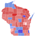
2022 Wisconsin gubernatorial election results map by county.svg 810 × 810; 43 KB
-
2024 United States gubernatorial elections retirements map.svg 959 × 593; 76 KB
-
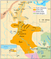
7.1a-North-Khanty traditional.png 1,797 × 2,092; 311 KB
-
7.1b-North-Khanty current.png 1,797 × 2,098; 304 KB
-
7.2a-East-Khanty traditional.png 2,109 × 2,059; 326 KB
-
A map of Europe to illustrate territorial changes since 1914 (5003859).jpg 5,000 × 3,912; 2.34 MB
-
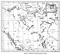
A sketch map of the linguistic area of Europe (North East) (5003791).jpg 5,000 × 3,977; 3.2 MB
-
Abu Sinan.JPG 223 × 125; 5 KB
-
Administrative map of Nigeria 1965.jpg 5,727 × 4,846; 4.93 MB
-
African countries by HDI (2020).svg 1,000 × 1,000; 185 KB
-
Age for Buying Guns - Global.svg 512 × 260; 999 KB
-
Age of Consent - Global.svg 512 × 260; 873 KB
-
Age of Majority - Global.svg 512 × 259; 972 KB
-
Ahuachapán.svg 512 × 395; 19 KB
-
Anti-spam by CleanTalk 1.png 1,177 × 509; 50 KB
-
Appraisers.com - Map of the United States - May 2002.gif 450 × 303; 15 KB
-
Arab League map (equirectangular projection).svg 605 × 340; 175 KB
-
Arab world.png 330 × 216; 11 KB
-
Arabian Peninsula (orthographic projection).png 2,000 × 2,000; 666 KB
-
Arapski u svijetu.png 659 × 388; 88 KB
-
Argentina - Frentes ganadores de elecciones provinciales 2023.svg 512 × 1,085; 241 KB
-
Argentine 2023 General Election Map.svg 512 × 475; 1.09 MB
-
BAAZ Escuadrilla Aeronaval de Exploración ARA parche.png 1,600 × 1,572; 1.31 MB
-
Basic shape of Listenbourg fictional country black.svg 1,055 × 1,107; 5 KB
-
Basic shape of Listenbourg fictional country.svg 1,055 × 1,107; 7 KB
-
Bear Grylls Survivor world map.png 800 × 351; 60 KB
-
BedfordshireNumbered.png 200 × 307; 19 KB
-
Biogeographique.jpg 260 × 246; 9 KB
-
Blank Map Africa surroundings equirect.svg 380 × 380; 175 KB
-
BlankMap-USA-states-Canada-provinces.png 2,289 × 1,744; 29 KB
-
BlankMap-USA-states-Canada-provinces.svg 2,289 × 1,744; 211 KB
-
Bloque Nacional Popular Galego.jpg 1,292 × 1,280; 607 KB
-
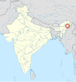
Borduria - Tirap district - Arunachal Pradesh - India - location map.svg 1,500 × 1,615; 1.23 MB
-
Cabañas.svg 512 × 395; 31 KB
-
California contour.svg 512 × 857; 44 KB
-
Canada blank map.svg 1,114 × 942; 205 KB
-
Canadian provinces and territories by HDI (2015).svg 512 × 493; 103 KB
-
Canadian provinces and territories by HDI (2018).svg 512 × 493; 91 KB
-
Cannabis Purchase Age - North America and rest.svg 512 × 544; 137 KB
-
Carte Listenbourg.jpg 1,117 × 812; 105 KB
-
Chalatenango.svg 512 × 395; 31 KB
-
Chyslo 01 04-5-1.png 733 × 888; 403 KB
-
CIS (orthographic projection).svg 541 × 541; 558 KB
-
Collective Security Treaty Organization (no borders).png 600 × 600; 215 KB
-
Collective Security Treaty Organization (orthographic projection, no borders).png 2,000 × 2,000; 707 KB
-
Collective Security Treaty Organization orthographic projection.svg 541 × 541; 613 KB
-
Colorado-River-Aqueduct-Map1.jpg 2,840 × 1,296; 5.09 MB
-
Commerce Bank U.S. Footprint.png 2,070 × 1,399; 232 KB
-
Countries by Human Development Index (2019), score changes.svg 2,911 × 1,297; 2.09 MB
-
Countries by Human Development Index (2019).png 6,060 × 2,737; 1.49 MB
-
Countries where Bhojpuri is spoken.png 1,425 × 625; 48 KB
-
COVID-19 Cases in California by counties.svg 621 × 733; 258 KB
-
COVID-19 Cases in New York (state) by counties.svg 512 × 384; 263 KB
-
COVID-19 Cases in Sweden by Municipality (Total Number).svg 290 × 654; 252 KB
-
COVID-19 Cases in Washington (state) by counties.svg 512 × 333; 231 KB
-
COVID-19 in Columbus.svg 512 × 331; 182 KB
-
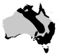
Crinia distribution.png 300 × 275; 19 KB
-
Crisis Trends anxiety map August 2014.png 1,600 × 929; 170 KB
-
Cuban provinces (December 1976).png 770 × 460; 344 KB
-
Cuscatlán.svg 512 × 395; 27 KB
-
Data on food deserts.png 1,034 × 556; 795 KB
-
Departamento de La Paz.svg 512 × 395; 28 KB
-
Departamento de San Miguel.svg 512 × 395; 37 KB
-
Departamento de Santa Ana.svg 512 × 395; 26 KB
-
Departamentos de El Salvador.svg 1,200 × 800; 4.57 MB
-
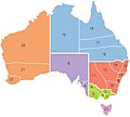
Dioceses of Anglican Church of Australia, 2019.jpg 1,001 × 901; 43 KB
-
Distritos de El Salvador.svg 1,200 × 800; 9.23 MB
-
Donga-Mantung.jpg 1,414 × 967; 131 KB
-
Drinking Age - Global.svg 512 × 260; 974 KB
-
Drinking Age - USA (1969).svg 512 × 325; 43 KB
-
Drinking Age - USA (1975).svg 512 × 325; 44 KB
-
Drinking Age - USA (1983).svg 512 × 325; 43 KB
-
Driving Age - Global.svg 512 × 260; 939 KB
-
EC-EU-enlargement animation.gif 680 × 520; 381 KB
-
Editorial Toxosoutos.png 244 × 100; 11 KB
-
EHIC participants.svg 680 × 540; 414 KB
-
Elections US 2020 Etats.png 1,513 × 983; 41 KB
-
ElectricityUCTE-hu.svg 1,280 × 1,360; 370 KB
-
ElectricityUCTE.svg 1,450 × 1,400; 353 KB
-
Equalization of Ages of Consent.svg 512 × 260; 1,017 KB
-
Ermenistan Cumhuriyeti.jpg 2,020 × 1,554; 173 KB
-
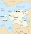
Estonya harita.png 345 × 370; 160 KB
-
EU Single Market.svg 1,300 × 1,300; 441 KB
-
EU-Romania.svg 2,045 × 1,720; 7.33 MB
-
Europe (orthographic projection).svg 541 × 541; 239 KB
-
Europe orthographic Caucasus Urals boundary (with borders).svg 537 × 536; 411 KB
-
Europe orthographic Caucasus Urals boundary.svg 537 × 536; 77 KB
-
Europe with and without Listenbourg fictional country grayscale.svg 961 × 1,400; 484 KB
-
Europe with and without Listenbourg fictional country.svg 2,087 × 1,166; 882 KB
-
European Union Ukraine Locator.svg 593 × 606; 711 KB
-
Eurozone Internal.svg 450 × 450; 793 KB
-
Fictional country from reversed map of France.svg 1,055 × 1,107; 83 KB
-
Fictional country Listenbourg color map.svg 1,720 × 1,248; 249 KB
-
Fictional country Listenbourg five regions and capital.svg 1,000 × 1,000; 46 KB
-
Fictional country Listenbourg map.svg 1,720 × 1,248; 249 KB
-
Fictional country location in Europe - cropped.svg 1,000 × 631; 344 KB
-
Fictional country location in Europe.svg 1,000 × 1,107; 464 KB
-
Flag Desecration Legality.svg 512 × 260; 879 KB
-
Flag-map of the Malvinas Islands.svg 512 × 417; 121 KB
-
France location in Europe.svg 1,000 × 1,107; 524 KB
-
From France upside down to Listenbourg fictional country.svg 1,055 × 1,107; 502 KB
-
Fu-Go balloon bomb incident locations, Alaska.jpg 1,548 × 1,394; 1,010 KB
-
Fu-Go balloon bomb incident locations, Canada.jpg 1,545 × 1,393; 1.1 MB
-
Fu-Go balloon bomb incident locations, Hawaii.jpg 1,557 × 1,390; 818 KB
-
Fu-Go balloon bomb incident locations, United States and Mexico.jpg 1,545 × 1,393; 1.11 MB
-
Fu-Go balloon bomb launch sites and following stations.jpg 543 × 704; 169 KB
-
G5 G7+1 G20.svg 512 × 260; 791 KB
-
Gambling Age - Global.svg 512 × 260; 921 KB








.svg/120px-2019_UN_Human_Development_Report_(inequality-adjusted).svg.png)










.svg/120px-2020_UN_Human_Development_Report_(inequality-adjusted).svg.png)


.svg/120px-2020_United_States_House_of_Representatives_Election_in_Michigan_(By_County).svg.png)



.svg/120px-2021_United_States_state_legislative_elections_(lower_house).svg.png)
.svg/120px-2021_United_States_state_legislative_elections_(upper_house).svg.png)







.jpg/120px-A_map_of_Europe_to_illustrate_territorial_changes_since_1914_(5003859).jpg)
_(5003791).jpg/120px-A_sketch_map_of_the_linguistic_area_of_Europe_(North_East)_(5003791).jpg)


.svg/120px-African_countries_by_HDI_(2020).svg.png)


.svg/120px-Arab_League_map_(equirectangular_projection).svg.png)

.png/120px-Arabian_Peninsula_(orthographic_projection).png)


.jpg/120px-Austria_and_her_frontiers_showing_fortified_towns%2C_naval_stations%2C_British_consulates_and_railways_(5008066).jpg)








.svg/120px-Canadian_provinces_and_territories_by_HDI_(2015).svg.png)
.svg/120px-Canadian_provinces_and_territories_by_HDI_(2018).svg.png)


.svg/120px-CIS_(orthographic_projection).svg.png)
.png/120px-Collective_Security_Treaty_Organization_(no_borders).png)
.png/120px-Collective_Security_Treaty_Organization_(orthographic_projection%2C_no_borders).png)


%2C_score_changes.svg/120px-Countries_by_Human_Development_Index_(2019)%2C_score_changes.svg.png)
.png/120px-Countries_by_Human_Development_Index_(2019).png)


_by_counties.svg/120px-COVID-19_Cases_in_New_York_(state)_by_counties.svg.png)
.svg/53px-COVID-19_Cases_in_Sweden_by_Municipality_(Total_Number).svg.png)
_by_counties.svg/120px-COVID-19_Cases_in_Washington_(state)_by_counties.svg.png)


.png/120px-Cuban_provinces_(December_1976).png)




.svg/120px-Drinking_Age_-_USA_(1969).svg.png)
.svg/120px-Drinking_Age_-_USA_(1975).svg.png)
.svg/120px-Drinking_Age_-_USA_(1983).svg.png)



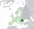
.svg/120px-Europe_(orthographic_projection).svg.png)
.svg/120px-Europe_orthographic_Caucasus_Urals_boundary_(with_borders).svg.png)


